A Day Out on the Amazing Salt Spring Island

Disclaimer: This blog contains affiliate links meaning I earn a small percentage of every purchase at no cost to you.

Salt Spring Island is the largest island in the Southern Gulf Islands. You can access to Salt Spring Island by a ferry either from Vancouver Island or the Mainland. In my eyes, it is worth a day visit. The ferry leaves from Crofton on Vancouver Island and arrives at Vesuvius, Salt Spring Island. The journey only takes 25 minutes and a full day of exploring awaits. I would recommend having a car for this trip. There is a small bus route around the island but not very practical.

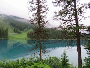
Salt Spring Island is famous for its Art Culture, organic farming, rugged coastlines, and natural beauty. There is plenty to explore on the island. We knew what we wanted to see and set off early. Also, starting early helps you to avoid hiking in the mid-day sun especially in the height of summertime. This is a must as it gets very hot.

A Morning Hike up the Magical Mount Erskine

The first point of call from the ferry was Mount Erskine. The trailhead was confusing to find. It does indeed have multiple entrances. The first entrance we arrived at looked like it was someone’s house (or so we thought). So, we did a bit more googling and found another starting point. We headed over to that one. This looked much better as there was a trailhead this time. I am not completely sure which trail we did, to be honest. We parked up at a turn-around area; I couldn’t tell you what road it was on.

Before setting off up Mount Erskine in search of what this trail offers, breakfast was on the menu. One of the best things about van life is you pick what view you have when you eat. This morning’s option didn’t disappoint.

Starting the Trail…

Fairy Doors at Salt Spring Island
The Only Fairy Door We Found

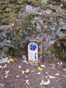
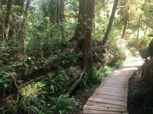
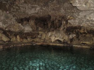
The trail started by entering a small clearing. As you enter you do get the feeling this is a magical place. The point of doing this trail is to find the fairy doors that lay throughout the forest. I had decided on wearing flip-flops. Therefore, to some people my choice of footwear is silly. I know it sounds silly but I feel like I have more grip.

We only found one fairy door on the hike and we didn’t quite make it to the top. It was a very unclear trail and people had made their own paths. At one point we ended up walking along a very narrow, steep, sheer drop cliff. Don’t get me wrong the sea view was amazing and worth it but this definitely got the heart racing. This was way more intense than the morning stroll I was expecting.

The View from Mount Erskine

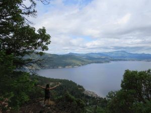
Overall, this trail was a good hike. If you come, I would do some research on where the fairy doors as are they are hard to find. I believe there are many fairy doors so hopefully, you have better luck than us at finding them!!

Ruckle Provincial Park on Salt Spring Island

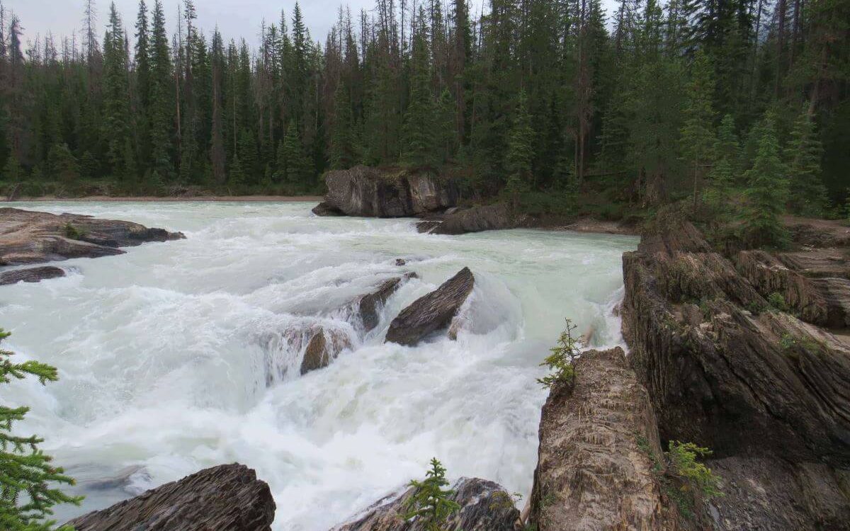
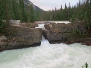
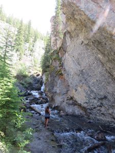
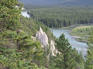
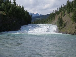
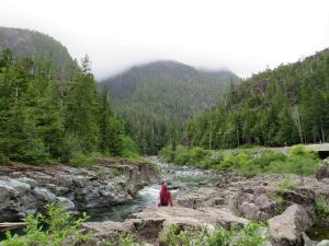
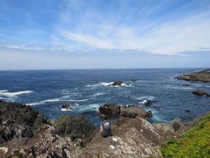
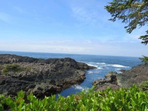
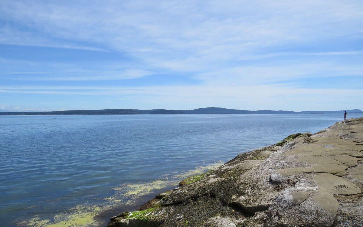
Ruckle Provincial Park is a coastal park that starts at Beaver Point on the South-Eastern shore of Salt Spring Island. The trail was a one-way 7 km hike to King’s Cove. In comparison, this was a nice relaxing walk compared to the climb up Mount Erskine. The trail was at sea level taking you through different landscapes. As well as an abundance of wildlife to look out for such as orcas, otters, and birdlife.

Dancing at Ruckle Provincial Park

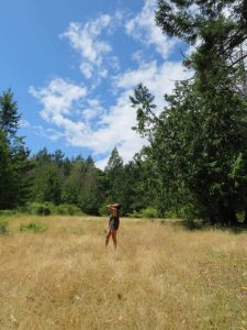
Ruckle Provincial Park’s coastal path has amazing ocean views. The trail isn’t clearly marked either (seems to be the theme of the island). At times we went off course yet it was fun exploring the surroundings. There were times where we were hugging the coastline climbing over rocks. Most of the trail edged along rocky headlands, tiny coves, and bays to explore. Look out for rock pools. For us the tide was high so we didn’t see the colourful range of crabs and other species.

When away from the coastal path you work your way through the forest. Listen out for birds and watch out for turkeys and chickens. The Quartz Fields is the other landscape to view. Yes, we did dance around like idiots in the fields. No one else was around though.

A Relaxing re-charge at Beddis Beach

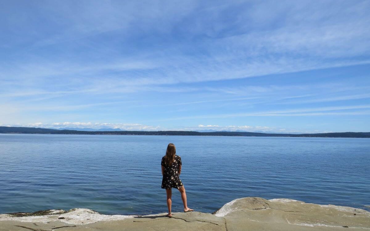
After all that hiking, we earnt this well-deserved afternoon at the beach. The beach was small but delightful. The beach we visited can be found at the end of Beddis Road. We parked on the side of the road, followed a path to the sand. Also, the beach was quiet which was surprising as the sun was out.

There were only about 5 other people on the beach. People were in the nude. There were no signs that we saw to indicate if it was a nudist beach. The water was a little cold but nice to wash off all the sweat!! We kicked back and topped up our tans in the mid-day sun.

Ganges Village

The Ganges Village is the largest village on Salt Spring Island found centrally on the east side of the island. The harbour was very busy and we watched many floatplanes come and go as we ate dinner.

Best Calamari on Salt Spring Island

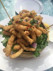
Well, being by the sea only means one thing for dinner; fish n chips. We shared delicious buttermilk calamari which was very tasty. The main course of fish n chips that followed didn’t disappoint either. All of the food was cooked to perfection. Finally, a good choice for our treat. When I am on a road trip eating out is rare as I try and save my budget for adventures.

Summary of Salt Spring Island

There is so much to see and do here and the island definitely has a laid back feeling to it. Also, there weren’t many other tourists either so that was great. The few people we did meet on hikes were locals with great tips and knowledge. These hikes were very different from popular hikes like the Grouse Grind. This place is worth the visit if you want to escape the crowds.

A Stunning Drive Through the Beautiful Yoho and Glacier

Disclaimer: This blog contains affiliate links meaning I earn a small percentage of every purchase at no cost to you.

This was the start of our road trip through the Canadian Rockies. We drove from Vancouver. Therefore for us, we entered Glacier National Park and then drive through Yoho National Park. Before hitting Banff and Jasper National Parks. Yes, they are all close together which is convenient. Yet, they do span a vast amount of BC and Alberta.

Rodger’s Pass Highway, Glacier National Park

I was ready to take on what is one of the most dangerous roads in North America. I suspected they are speaking about the Winter Season when it’s covered in snow. However, it was summer and the sun was shining. Rodger’s Pass winds its way through a gorgeous mountain range making this scenic drive simply magnificent. In every direction, you are surrounded by mountains.

Hemlock Grove, Yoho National Park

Hemlock Grove Glacier National Park
Boardwalk at Hemlock Grove

After a fair few hours of driving, we fancied stretching our legs. So, we stopped in at Hemlock Grove. This was a quiet boardwalk through old-growth forests. The path led us up close and personal with the soaring ancient Hemlock trees. The walk beneath the canopy is a cool relief from the sun burning down.

Rodger’s Pass Discovery Centre

I would describe the Discovery Centre as a mini-museum. To be able to enter all you do is show your park pass. It is small and informative but I find learning enjoyable. Although there was not much on display I still enjoyed it. The museum detailed the history of Rodger’s Pass and what wildlife lives in Yoho National Park.

Northern Lights Wildlife Wolf Centre, Golden, BC

I kept this stop as a surprise for my friend. Google maps was used as this place was really in the middle of nowhere. She definitely was surprised as we pulled into the car park. We went to a small unique sanctuary for wolves. We even timed it to perfection arriving at the start of the talk. The host was very knowledgeable and the talk was informative. We learnt a lot and saw wolves, therefore, it was worth a detour.  

Kicking Horse River

The Kicking Horse River is very powerful and loud. However, we found a picturesque free spot for the night. It was beautiful. Nice and relaxing, a real winner in free camping spots. We left early in the morning to continue the adventure. Leaving the nature spot just as we found it.

Natural Bridge Over The Kicking Horse River, Yoho National Park

Natural Bridge Yoho National Park
Impressive Formation of a Natural Bridge

As always, we enjoy stopping off at most of the viewpoints along the highway. This breaks up the drive and we get to see the awesome natural wonders of Yoho National Park. In addition, this stop was no different. The natural bridge is a naturally shaped rock formation and extends the entire width of the Kicking Horse River. Sculpted by the erosive forces of the rushing water.

Emerald Lake, Yoho National Park

Emerald Lake
The Beauty of Emerald Lake

This was one lake I was really excited to see; well if I’m honest I was enthusiastic about everything. So, when I saw the deep vibrant turquoise colour as the sun peaked through the morning clouds; I was beyond ecstatic. This is a glacier-fed lake like most of them in the park. The colour forms because of the slit that streams into the lake. Well worth a stop!

Takakkaw Falls, Yoho National Park

Takakkaw Falls in Yoho National Park
Takakkaw Falls

This giant waterfall stood at 260m with a waterwheel starting the flow. A waterwheel is where the water shoots upwards before rushing back down. This was impressive to watch. The short walk from the car park led us across a bridge to the waterfall. The waterfall is in view for most of the walk. The weather wasn’t great which meant the crowds were quiet. The water pounds down leaving you covered in spray.

Spiral Train Tunnels, Yoho National Park

Train Spiral Viewpoint
The Train Travelling Through The Spiral Tunnel

As we drove back down from the Takakkaw Falls to Rodgers Pass we pulled into a spot for some lunch. This spot was one of the two viewing platforms for the Spinal Tunnel. We didn’t know about this until a nice guy explained it to us. We were lucky to see the train pass through the tunnel. Trains are mostly cargo in Canada and can be up to 2 miles in length. Therefore, it did take some minutes for the whole train to pass.

What a Start to The Rockies

These two National Parks kicked started the excitement for Jasper National Park and Banff National Park. The scenery was incredible and the drive was pleasant. The breathtaking views made this trip worthwhile.

What to See in the Beautiful Town of Banff?

Disclaimer: This blog contains affiliate links meaning I earn a small percentage of every purchase at no cost to you.

The town of Banff is a very popular place to visit for tourists. Therefore, booking hotels or tours in advance is a must. This town was founded in 1883 when the Canadian Pacific Railway ran alongside the Bow River. The town is within the Banff National Park boundaries.

Therefore, you need a pass to enter. The pass costs around $10 for a day. We were on our road trip meaning we had a year pass for around $70 per person. The year pass is more cost-effective if you are visiting different National Parks and visiting for consecutive days.

Vermilion Lakes – The Lakes that Border Banff Town

Mountainous Backdrop at Vermillion Lake Outisde Banff Town
The Marshland Lakes

These lakes are a network of marshlands. They sit just outside of the town of Banff. These lakes are not glacier-fed like so many in Banff National Park. In the backdrop, you see Sulphur Mountain and Mount Rundle. Also, with the sun in the right direction, you can see the reflection of Mount Rundle on the water. This is home to a short boardwalk through some marshlands and a perfect place for a relaxing sunset.

The Historic Banff Town – Shopping and Restaurants

The town of Banff offers a range of restaurants, bars, and shops mixed with some art galleries. Also, many mountains surround the town giving you incredible views no matter which way you look. If you like a good keepsake, you can find these along Banff Avenue or Bear Street.

BeaverTails – Trying One of Canada’s Most Famous Foods

We had to try BeaverTails, a popular dessert or sweet snack. I opted for the Oreo flavour (I had an Oreo obsession at one point). If you Google foods to try in Canada, these pop up on your search. I am one for having a sweet tooth therefore I was in heaven. These were so tasty and a perfect afternoon treat. It was the sugar fix that I required. Yes… this fix is basically needed daily for me.

Cave and Basin National Historic Site – Banff Town

Sulphur Cave Basin a National Historic Site in Banff Town
The Cave Basin

The Sulphur Mountain Cave and Basin was where the National Park began. There is a mini-museum which is very informative detailing information about the area. It doesn’t take much time to wander around. This hot spring cavern is one of nine on Sulphur Mountain yet the only one that can fit people in. It’s called Sulphur Mountain for a reason so expect a smell when entering the cave.

A Short Trail Hike to Sundance Canyon

A Rocky Sundance Canyon with Flowing Water, Banff Town
The Sundance Canyon

There are many trails to do around this site. We decided on the Sundance Trail which was 4.3 km with a small elevation of 145 metres. Perfect. We didn’t want to be scaling any mountains today. The walk was causal and eventfully entered a small forest alongside the Bow River. Then you head down into the small canyon. The walk is the same way back to the car.

The walk was a good stretch of the legs. However, as we started the walk back big black clouds replaced the blue skies. We weren’t planning on going so far. So, we didn’t have our waterproofs with us. We raced back to try and beat the rain. Yep! You probably know how this ended.

We didn’t make it back to the car before the heavens opened… we got absolutely soaked. You can always count on the weather… not!

728*90

Banff Upper Hot Springs

When I think of hot springs in Canada, I am picturing a pool in the middle of nowhere. Not a ‘Spa’ facility. The Banff Upper Springs is quite small but a very popular stop with everybody. I refused to go in as it was too full but my friend did and she enjoyed the experience. The evening time was quieter and a little more relaxing (fewer people less noise). However, still, something that I wouldn’t enjoy.

Viewing the HooDoos at Tunnel Mountain

Hoodoo's at a Tree lined Bow Rvier,
The HooDoo’s

In the end, we chose to drive up Tunnel Mountain Road to take a look at The HooDoos. Although, there is a hike you can do that takes you closer to the hoodoos. HooDoos contain sedimentary rock covered by a harder rock which makes it harder to erode. Once softer sediment erodes rock needles or tower-like natural obstacles form known as Hoodoos.

Bow River – The River Runs from Bow Lake to Calgary

The Bow River is breathtaking and a marvellous bit of nature here within the National Parks. It flows for an impressive 587 km from the source at Bow Lake to Calgary, Alberta. There are many things to do along the river such as kayaking. In the town of Banff near Fairmount Hotel, there is Bow Falls.

Bow Falls into The Bow River Which Runs To Calgary
Bow Falls, Bow River

This waterfall is short and wide yet still so powerful. From mid-summer, you can feel the mist on your face due to the high water levels. The high water level is due to all the snowmelt in the region. The undisturbed view back down the valley is breathtaking. The river winded its way into the distance. There are no words to describe the sheer beauty of the Bow River.

Summary of a Day Visit in Banff Town

Banff is well worth the visit. A day can be well spent visiting all the major spots on offer. We planned which hikes we wanted to do in advance and none of them were in Banff. There are plenty of hikes in and around Banff however you need more than one day!

Driving Along The Attractive Highway 4 – Nanaimo to Tofino

Disclaimer: This blog contains affiliate links meaning I earn a small percentage of every purchase at no cost to you.

After getting the ferry from North Vancouver (Horseshoe Bay) to Nanaimo; we headed down to Tofino, a small surf town located on the West Coast of Vancouver Island. It is an easy drive, meaning you can’t get lost as you take Highway 4 all the way there. There are many beautiful stops along the way. So, take the whole day to do this drive instead of 3 hours. You will cover roughly 207 km.

Little Qualicum Falls Provincial Park – Nanaimo to Tofino

Little Qualicum Falls - Nanaimo to Tofino route
Lower Falls

This is the first stop on your way from Nanaimo to Tofino. Little Qualicum Provincial Park is about 9.3 km west of Highway 4. The trail loop is family-friendly. It has viewing points for both the lower and upper falls. These sit on either side of the Little Qualicum River. The waterfall was impressive and found by wandering through the plush forest. The crystal blue water was rapid and raged through the deep canyons. A perfect place to stretch the legs.

Nanaimo to Tofino – Cathedral Grove at MacMillan Provincial Park

Giant Red Cedar Tree on the way from Nanimo to Tofino
Me and a 800-year-old Cedar

After a short drive, you arrive at the next stop, Cathedral Grove. Cathedral Grove is home to the biggest and oldest Douglas Fir Trees and Giant Red Cedars. The trails are family-friendly and are on either side of the road. This place gets busy making it difficult to park. We arrived there around mid-morning and even that was a challenge. The parking is simply a pullover on either side of the highway. Please be aware of traffic and pedestrians especially in the summer months when crossing or driving.

Within this Provincial Park sits trees up to 800 years old. The sheer size of the Douglas Fir and Red Cedars are unbelievable and something you have to witness. The forest here is rich in different shades of green ranging from ferns, moss, and trees towering above. One of the short walks was less busy than the other. So as you strolled along the boardwalk you could hear birds chirping away. Peaceful.

Nanaimo to Tofino – A Hole in a Wall at Port Alberni

Hole in the Wall Nanaimo to Tofino
The Cool Random Hole in The Wall

The hole in the wall was our third stop as we travelled from Nanaimo to Tofino. The hole in the wall is a hidden unique stop as you enter Port Alberni. There is a dirt pull-out on the north side of the highway just before the Coombes Country Candy Store. Once parked up we crossed the highway on foot to find the hidden gravel pathway by the concrete barrier. Kind strangers have mounted small wooden signs to help you navigate the 15-minute walk to the hole in the wall.

The history goes that the locals blasted a hole for a water pipeline. Nowadays, it isn’t used and the water flows nicely over the rocks. When we were there wasn’t much water following. It now sits as a quirky photo opportunity and a peaceful stroll along the dirt path.

Wally Creek – Kennedy River Love Locks

After, we cooked our lunch at the port in Port Alberni. Also, we finished lunch just in time as the rain started to pour. We decided to continue the drive down towards Tofino. As we drove away, the mountainous rugged portion of the drive started. Following the incredible landscape for 56 km before coming to Wally Creek alongside the Kennedy River.

Wally Creek Nanaimo
The Magical Feel to Wally Creek

On a metal fence, people can leave locks for their loved ones unfortunately this wasn’t all that was left. RUBBISH or TRASH as some might call it. When adventuring and exploring these places we are entering nature, please pack out what you bring in. This fence hindered the experience.

In the other direction, away from the stupid ‘love locks’ fence, the views are amazing. Looking back up the river the views were the best we had seen on this journey. The Mountains were poking out from behind the misty backdrop. I couldn’t help but take it all for a while. The rain had stopped so the air was nice and cool. Carefully, we climbed over the rocks to get closer to the Kennedy River. Getting closer allowed us to get a sense of how powerful the water flow is.

Giant Red Cedar Trail

As we slowly edged closer to Tofino, the next stop was only 6 km from Wally Creek. Although hard to find it was worth it. Drive slowly and look for a small sign that signals the start of the trail. The dirt trail gives you a more intimate experience compared to the dug-out trail at Cathedral Grove. This particular forest lets you see the uniqueness of the Giant Red Cedars. Also, explore the river bank to take in more views of the Kennedy River.

The Forest Interpretive Trail

The pull-out for this stop is 1.5 km before the Pacific Rim Visitor Centre junction. So, if you hit the centre you have gone too far. This walk is different from the others as it educates you on the importance of rehabilitating the forests. If you are like me and love learning then this short walk is for you. As you maneuver your way along the boardwalk, you will see the importance of ensuring the health to restore old growth.

Wild Pacific Trail Ucluelet

Wild Pacific Trail
Taking The View In on The Wild Pacific Trail

We found a free spot to park for the night so that all could spend the day exploring Ucluelet (ukee… as locals call it). This is a small town located at the opposite end to Tofino in the Pacific Rim National Park. After filling up on a cooked breakfast at The Blue Room Cafe, we were ready for a day of hiking.

Wild Pacific Trail: Browns Beach to Rocky Bluffs

Wild Pacific Trail
The Rocky Coastline

Our first trail was from Browns Beach to Artists Loop (2.75 km) which cuts through a forest including oceanside vistas. The Rocky Bluffs is a 3 km return track along the coastline with incredible views. Also, this coastal hike includes a 1 km detour around the Ancients Cedar section. We spent the whole morning exploring all these trails. A good way to burn off the big breakfast.

Wild Pacific Trail: The Lighthouse Loop

Also, we did the 2.6 km loop known as the Lighthouse Loop. The trail starts at the 100-year-old Amphitheater Lighthouse before winding north along the rugged coastline. We completed this trail in the evening light. A perfect backdrop to watch the sun go down. To break up these two hikes we spent the afternoon visiting the beaches in Ucluelet. We topped our tans at Little Beach and Terrence Beach. Both nice and quiet.

Summary of the Scenic Pacific Rim Highway

This drive from Nanaimo to Tofino is something I highly recommend. Although lots of walking these stops were a welcome break from sitting behind the wheel. Again, this route is best if you have a car or hire one. As you can stop where you like, when you want, and forever for how long you wish.

A Road Trip in the Sensational Jasper National Park

Disclaimer: This blog contains affiliate links meaning I earn a small percentage of every purchase at no cost to you.

Jasper National Park is so beautiful just like Banff National Park. The Rocky Mountains have by far been the best views I’ve seen in Canada. Unfortunately, we only spent one day in Jasper as I was unwell and needed a cheaper doctor. We spent the day travelling up to Maligne Lake and back. I would definitely like to spend more time in Jasper National Park next visit.

To gain access to all national parks in Canada; you need a pass. Day tickets are around CAN$10 or you can purchase a year pass for around CAN$70. If you are visiting many national parks the years’ pass is more costive effective.

The Icefields Parkway Drive Through Jasper National Park

Icefields Parkway is the main highway through Jasper National Park. The Icefields Parkway runs for 230km from Lake Louise to the Town of Jasper. Driving it in both directions is a must. The views are breath-taking and some of the best you will ever see. Both directions are unreal.

Bow Glacier Falls Hike, Bow Lake

I was so excited to do this hike. We set off on this hike thinking it was 2km to the Bow Glacier Falls. The trail is in fact 8.7 km there and back. The trail is so pretty as it runs alongside Bow Lake. The hike takes you along the side of the river. Next, at a small clearing, the hike continues along the river bed. If you end up going up and through trees, you’ve missed the exit to the river bed. It is perfect weather not too hot or too cold for a change. A constant temperature so you weren’t always laying up and delaying. A refreshing change.

Me standing on the shore of Bow Lake in Jasper National Park
Bow Lake

I hike in flip-flops most of the time unless I know it’s going to be a long one. I find it comfier than trainers or hiking boots. We were on the hike for maybe an hour and a half then the worst thing happened. Unfortunately, flip-flops can be easy to break and yes that happened to me on this hike. Okay! Not quite the worst thing but it did put a stop to the hike. I tried to go on but it was all stones. Stones are my weak point and I cannot walk on them. So, we missed out on the Bow Glacier Falls. I felt gutted. If only I wore my trainers. Oh well, hindsight is a wonderful thing!

Viewing the Breath-taking Colour of Peyto Lake

The bright blue Peyto Lake in Jasper National Park
The Beautiful Peyto Lake

By the time we arrived at this lake, it was packed with tourists. However, that didn’t mean we could miss it as it is a must-see. It is a short 2.9 km hike to the viewing platform. This platform overlooks Peyto Lake. One word. Wow! The colour of Peyto Lake was incredible. You couldn’t even imagine it to be this good. I was still shocked even though I had seen many pictures of the lake. It is the rock flour that gives this glacier-fed lake its vibrant-blue colour. The colour simply pops and it will leave you speechless. Nothing compares to seeing this lake with your own eyes.

A Stop by Mistaya Canyon

Mistaya Canyon Jasper National Park
Mistaya Canyon

Mistaya Canyon was an early morning stop. After parking the car on a highway pullout, it is about a 5- 10 minute walk. The canyon is clearly signposted, so getting lost is impossible. As you walk along you can hear the river roaring past. After a short downhill walk, you reach the bridge. That is when all of a sudden the impressive slot canyon is insight. This canyon is truly a beautiful, natural wonder of nature.

The Hike Along Parker Ridge

Parker's Ridge Jasper National Park
The Valley on the Parker Ridge Hike

Parker Ridge hike was a simple 5km and after 2km you are hiking along the ridge. It wasn’t too strenuous. But I was ill so there was plenty of stopping along the way. The path zig-zags up the mountain before hiking along the steep ridge. It takes a small effort to climb the steep section at the start but after that, it’s all flat. However, you are then rewarded with great views of the Saskatchewan Glacier.

Athabasca Glacier and The Columbia Icefields

As the highway continues North you reach The Columbia Icefields section. The Columbia Icefields are the largest in North America covering around 325km squared and an average elevation of 3000m.

Crowfoot Glacier on Crowfoot Mountain

Crowfoot Glacier Jasper National Park
The Melting Crowfoot Glacier

The Crowfoot Glacier is visible from a lookout point on the side of the Icefields Parkway Highway. It is a glacier on the North-Eastern side of Crowfoot Mountain, overlooking Bow Lake. Simply put it’s shaped like a crow’s foot hence the name. However, it is melting therefore when we saw the crow’s foot, it had already lost a claw. The glacier water flows into the remarkable Bow River. This river runs from Bow Lake all the way to Calgary. Craving a remarkable flow of water through the valley.

Maligne Lake, Jasper National Park

Maligne Lake is 22km long and the second largest lake in the Canadian Rockies. The colour of the azure blue is unbelievable. Also, it looks very inviting for a swim but don’t be fooled, it is way too cold for that. Maligne Lake has an elevation of 1,670 metres above sea level.

Lake Maligne Jasper National Park
Lake Maligne in Summertime

Here we took the boat trip on offer at Maligne Lake. We were extremely lucky as we didn’t book in advance. I would highly recommend the boat ride as well as booking in advance. The boat ride isn’t the only option to explore Spirit Island, you can also rent kayaks. However, I was too ill to do any more exercise. The Hike up Parker’s Ridge was enough for me.

Our tour guide was new to the job but this didn’t hinder the experience. She was awesome and provided us with all the facts as we travelled up to Spirit Island. The Canadians gifted our Queen (Great Britain) a mountain range for her birthday one year. The Queen Elizabeth Mountain Range sits on the shoreline of Maligne Lake. This mountain range as it’s shaped like a ‘J’ making it different from the standard linear-shaped ranges. Very unusual.

Travelling Back Down the Icefield Parkway Highway

So, we missed some stops on the way up. Yet, planned to hit them on the way back down. The joys of travelling the road both ways. I highly recommend doing the drive in both directions. You get very different views but all equally as beautiful and breathtaking. You can stop at the highlights in any order you would like. The joys of road tripping.

Athabasca Falls, Jasper National Park

Athabasca Falls sits at 23 metres, not the tallest waterfall within Jasper National Park. However, it is the most powerful due to the sheer volume of water that flows from the Athabasca River. Another mind-blowing canyon falls. Yet if you visit in the evening can witness an incredible alpenglow on the mountainous backdrop.

Sunwapta Falls, Jasper National Park

A short walk from the car, two waterfalls flow into the River Sunwapta. We didn’t do any of the hikes on offer as time was pressing on. The falls were great to view due to the gorgeous mountain backdrop and descend into a limestone gauze.

From the highway, you can see Kerkeslin Lick Goats. All you do is slow the car down and witness the mountain goat licking the salty minerals left behind. These are about 15 minutes North of Sunwapta Falls.

Tangle Creek Falls

This is a little waterfall on the side of the Icefields Parkway. Delicate multi-tiered waterfall on a cliff face. You can view it straight from your car as it is on the side of the road. Yet, it was nice to get out and stretch my legs. I had already done so much driving and had plenty more to do.

Big Bend Viewpoint

You can’t miss it, it is quite literally a big bend when you come back South from Jasper. We pulled in here to enjoy the view but I noticed that my car felt cold. I lifted the bonnet of the car to find that the oil cap had come off. However, it didn’t dampen my spirits because the view was incredible.

At this point, there is no cell phone service. Therefore, we kept going until we got to the motel at Saskatchewan Crossing. It all worked out in the end. We called BCAA and got a tow truck instead of risking the car. It was a welcome relief not to drive the last 200 km to Canmore. We made it safely to Canmore where we went straight to sleep.

Summary of Jasper National Park

Overall, the national park didn’t disappoint in any way. It was amazing just like Banff National Park. It was all breathtaking and I love nature so I felt right at home exploring the trails. I wish we had more time to really explore Jasper on longer hikes but I needed rest and a doctor. Jasper National Park is worth the visit even if you only have a day like us.